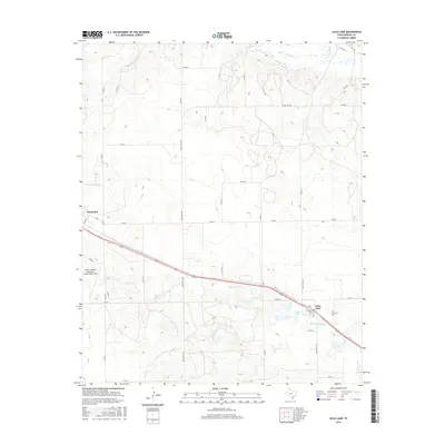
2016 Map of Lelia Lake
USGS Topo · Published 2016About this map
The Salt Fork Red River defines the northern edge of this Panhandle landscape, where the agricultural flats of Donley County meet the breaks of the Red River valley. The settlement of Clarendon anchors the western margin, serving as a regional hub for the surrounding ranchlands. Further east, the community of Lelia Lake sits along a prominent transportation corridor, characterized by a series of significant water bodies including Lelia Lake itself, Johnson Lake, and the marshy basins of the Taylor Lakes and Cattail Lake. This area reveals a complex hydrological network of ephemeral creeks like W Lelia Lake Cr and E Lelia Lake Cr that drain the high plains. The presence of Smiley Johnson Municipal Airport/Bass Field south of Clarendon highlights the infrastructure supporting this rural expanse in the early 21st century.
Find a feature on this map
42 named features on this map. Tap any name to fly to it.
Don’t see what you’re looking for? This feature index may not catch every label — zoom into the map to look around manually.
Map Details
Editions of this 2016 Lelia Lake Map
This is the sole edition of this map. No revisions or reprints were ever made.
Other maps of this area

1954 · Amarillo
USGS Topo · 1:250,000

1954 · Plainview
USGS Topo · 1:250,000

1958 · Amarillo
USGS Topo · 1:250,000

1958 · Plainview
USGS Topo · 1:250,000

1959 · Lelia Lake Creek
USGS Topo · 1:24,000

1959 · Troublesome Creek
USGS Topo · 1:24,000

1962 · Lelia Lake
USGS Topo · 1:24,000

1962 · Roach Ranch
USGS Topo · 1:24,000

1962 · Griffin Ranch
USGS Topo · 1:24,000

1963 · Hedley
USGS Topo · 1:24,000