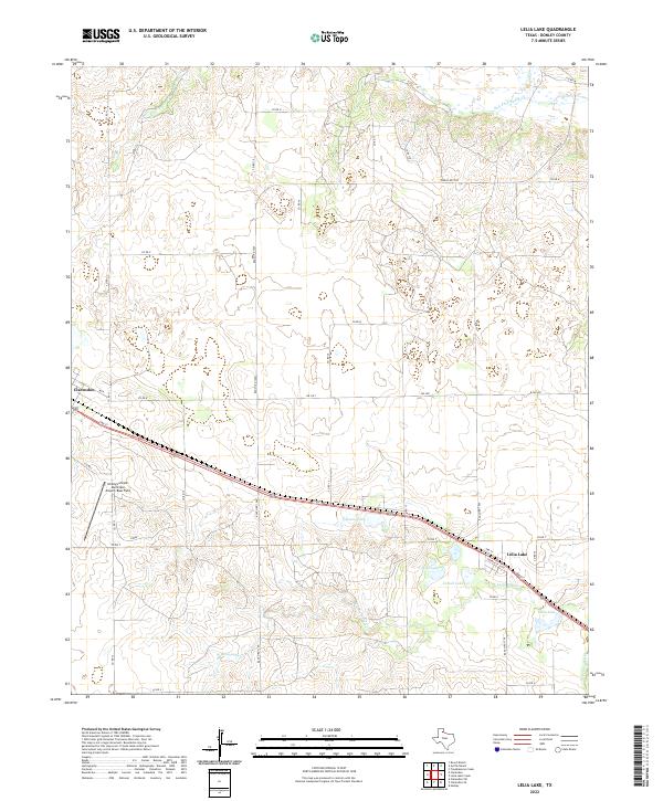
2022 Map of Lelia Lake
USGS Topo · Published 2022About this map
The Salt Fork Red River carves through the northern reaches of this Donley County landscape, where the flat Texas Panhandle breaks into complex drainage systems. Centered on the community of Lelia Lake, the area is defined by a series of distinct water bodies including Johnson Lake, Taylor Lakes, and Cattail Lake. These features, along with W Lelia Lake Cr and E Lelia Lake Cr, indicate a hydrologically active corridor in a region otherwise characterized by a vast network of section-line roads and cattle-grazing land.
Find a feature on this map
35 named features on this map. Tap any name to fly to it.
Don’t see what you’re looking for? This feature index may not catch every label — zoom into the map to look around manually.
Map Details
Editions of this 2022 Lelia Lake Map
This is the sole edition of this map. No revisions or reprints were ever made.
Other maps of this area

1954 · Amarillo
USGS Topo · 1:250,000

1954 · Plainview
USGS Topo · 1:250,000

1958 · Amarillo
USGS Topo · 1:250,000

1958 · Plainview
USGS Topo · 1:250,000

1959 · Lelia Lake Creek
USGS Topo · 1:24,000

1959 · Troublesome Creek
USGS Topo · 1:24,000

1962 · Lelia Lake
USGS Topo · 1:24,000

1962 · Roach Ranch
USGS Topo · 1:24,000

1962 · Griffin Ranch
USGS Topo · 1:24,000

1963 · Hedley
USGS Topo · 1:24,000