
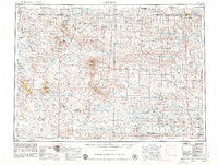
1954 Map of Lemmon
USGS Topo · Published 1964About this map
The North Fork Grand River and South Fork Grand River converge at the Shadehill Reservoir in this mid-century survey of the high plains. This is a landscape defined by its isolated buttes and extensive network of rural school districts, including Scotch Cap School and Grand River School No 1, which supported a dispersed ranching population. The Chicago Milwaukee St Paul and Pacific railroad runs along the northern border, anchoring the town of Lemmon, while the Custer National Forest encompasses distinctive landforms like The Castles and Slim Buttes to the west. The map captures the region's geography before significant consolidation, preserving the locations of numerous small settlements such as Prairie City, Zeona, and Camp Crook along the Little Missouri River.
Find a feature on this map
162 named features on this map. Tap any name to fly to it.
Don’t see what you’re looking for? This feature index may not catch every label — zoom into the map to look around manually.
Map Details
Editions of this 1954 Lemmon Map
2 editions found
Other maps of this area

1901 · Aladdin
USGS Topo · 1:125,000

1903 · Aladdin
USGS Topo · 1:125,000

1905 · Indian
USGS Topo · 1:62,500

1906 · Two Top
USGS Topo · 1:62,500

1907 · Belle Fourche
USGS Topo · 1:125,000

1913 · Newell
USGS Topo · 1:125,000

1935 · Reva
USGS Topo · 1:125,000

1935 · Hoover
USGS Topo · 1:125,000

1935 · Harding
USGS Topo · 1:125,000

1935 · Buffalo
USGS Topo · 1:125,000