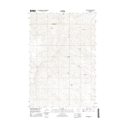
2017 Map of Lemon Ranch
USGS Topo · Published 2017About this map
Lemon Ranch sits at the center of this 2017 survey, marking a pocket of settlement within a landscape defined by the drainage systems of the Montana high plains. The topography is shaped by a series of significant coulees that carve through the terrain, including Wagon Box Coulee, Deadmans Coulee, and Sawmill Coulee. These features, along with Robs Coulee and Cotters Coulee, illustrate a complex network of seasonal watercourses and ridges. In the western portion of the map, the elevated terrain of Pine Ridge rises above the surrounding flats. The northern reaches are accessed via Reed Creek Rd, while the southern border is defined by the winding path of Chimney Cr. The map also captures the administrative boundary between Yellowstone County and Big Horn County, showing how modern political lines intersect with the natural geography of the Big Horn Basin region.
Find a feature on this map
15 named features on this map. Tap any name to fly to it.
Don’t see what you’re looking for? This feature index may not catch every label — zoom into the map to look around manually.
Map Details
Editions of this 2017 Lemon Ranch Map
This is the sole edition of this map. No revisions or reprints were ever made.
Other maps of this area

1894 · Fort Custer
USGS Topo · 1:125,000

1954 · Hardin
USGS Topo · 1:250,000

1954 · Forsyth
USGS Topo · 1:250,000

1957 · Hardin
USGS Topo · 1:250,000

1957 · Forsyth
USGS Topo · 1:250,000

1958 · Forsyth
USGS Topo · 1:250,000

1958 · Hardin
USGS Topo · 1:250,000

1960 · Foster
USGS Topo · 1:24,000

1960 · Ninemile Point
USGS Topo · 1:24,000

1960 · Chimney Creek
USGS Topo · 1:24,000