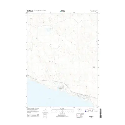
2014 Map of Lemoyne
USGS Topo · Published 2014About this map
McConaughy Lake dominates the southern margin of this Keith County landscape, where the high plains of western Nebraska meet the shoreline of the state's largest reservoir. The community of Lemoyne serves as a primary focal point along the northern coast, situated just above the water's edge where Ne-92 traverses the terrain. This coastal positioning is defined by the drainage of Lonergan Cr, which flows southward from the sandhills to join the reservoir.
Find a feature on this map
11 named features on this map. Tap any name to fly to it.
Don’t see what you’re looking for? This feature index may not catch every label — zoom into the map to look around manually.
Map Details
Editions of this 2014 Lemoyne Map
This is the sole edition of this map. No revisions or reprints were ever made.
Other maps of this area

1897 · Ogallala
USGS Topo · 1:125,000

1900 · Ogallala
USGS Topo · 1:125,000

1954 · North Platte
USGS Topo · 1:250,000

1956 · North Platte
USGS Topo · 1:250,000

1957 · North Platte
USGS Topo · 1:250,000

1967 · North Platte
USGS Topo · 1:250,000

1971 · Martin
USGS Topo · 1:24,000
1971 · Brule NW
USGS Topo · 1:24,000
1971 · Belmar
USGS Topo · 1:24,000
1971 · Bear Hill
USGS Topo · 1:24,000