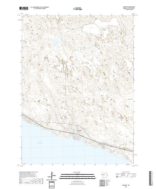
2021 Map of Lemoyne
USGS Topo · Published 2021About this map
Lemoyne sits on the northern edge of the massive Lake McConaughy reservoir, serving as a primary access point for the shoreline in Keith County. This 2021 survey documents the transition from the high sandhills to the water's edge, where the seasonal flow of Lonergan Creek enters the lake near the settlement's core. The landscape north of the reservoir is characterized by the rolling dunes of the Nebraska Sandhills, featuring isolated water bodies like Berry Lake and the broad depression of Ackley Valley. Local infrastructure is concentrated along the shore, with N Shore Rd providing access to recreational and residential pockets including Sandy Beach and Bay Meadows. The grid of Lemoyne Rd and French St marks the small community's layout, while Berry Rd winds northward into the cattle country of the high plains.
Find a feature on this map
16 named features on this map. Tap any name to fly to it.
Don’t see what you’re looking for? This feature index may not catch every label — zoom into the map to look around manually.
Map Details
Editions of this 2021 Lemoyne Map
This is the sole edition of this map. No revisions or reprints were ever made.
Other maps of this area

1897 · Ogallala
USGS Topo · 1:125,000

1900 · Ogallala
USGS Topo · 1:125,000

1954 · North Platte
USGS Topo · 1:250,000

1956 · North Platte
USGS Topo · 1:250,000

1957 · North Platte
USGS Topo · 1:250,000

1967 · North Platte
USGS Topo · 1:250,000

1971 · Martin
USGS Topo · 1:24,000
1971 · Brule NW
USGS Topo · 1:24,000
1971 · Belmar
USGS Topo · 1:24,000
1971 · Bear Hill
USGS Topo · 1:24,000