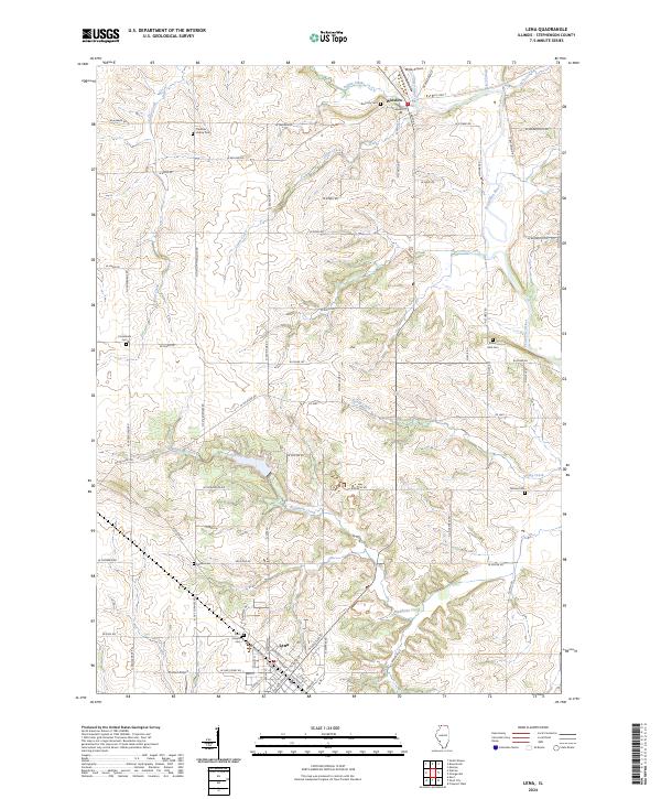
2024 Map of Lena
USGS Topo · Published 2024About this map
The village of Lena serves as the southern anchor for this section of Stephenson County, defined by a dense grid of rural roads and the winding course of the Pecatonica River to the north. This modern survey illustrates a landscape deeply rooted in its local history, where the terrain is punctuated by small community burial grounds like Christian Hollow Cem and Rock Lily Cem. The hydrological network is particularly prominent, featuring the confluence of Waddams Creek and Cedar Creek, which drain the agricultural uplands toward the river valley near Winslow. Small aviation facilities such as Kramer Airport and Mitek Airport highlight the area's contemporary infrastructure, while family-named landmarks like Manny Cem and Robey Wait Cem provide vital touchstones for genealogists tracing the legacy of the region's early settlers and farming families.
Find a feature on this map
76 named features on this map. Tap any name to fly to it.
Don’t see what you’re looking for? This feature index may not catch every label — zoom into the map to look around manually.
Map Details
Editions of this 2024 Lena Map
This is the sole edition of this map. No revisions or reprints were ever made.
Other maps of this area

1920 · Monroe
USGS Topo · 1:62,500

1922 · Monroe
USGS Topo · 1:62,500

1923 · South Wayne
USGS Topo · 1:62,500

1937 · Lena
USGS Topo · 1:48,000

1939 · Freeport
USGS Topo · 1:48,000

1942 · Lena
USGS Topo · 1:62,500

1943 · Lena
USGS Topo · 1:62,500

1944 · Freeport
USGS Topo · 1:62,500

1954 · Rockford
USGS Topo · 1:250,000

1955 · Rockford
USGS Topo · 1:250,000