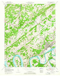
1953 Map of Lenoir City
USGS Topo · Published 1965About this map
Lenoir City sits at the confluence of the Tennessee River and the Little Tennessee River, serving as a focal point for the region's mid-century transit and industrial landscape. The mapping shows the waters of Watts Bar Lake winding through distinctive river loops such as Huff Ferry Bend and Jackson Bend. The presence of the Southern railroad and a pipe line terminal near the city center indicates a well-developed transportation network during this era.
Find a feature on this map
64 named features on this map. Tap any name to fly to it.
Don’t see what you’re looking for? This feature index may not catch every label — zoom into the map to look around manually.
Map Details
Editions of this 1953 Lenoir City Map
2 editions found
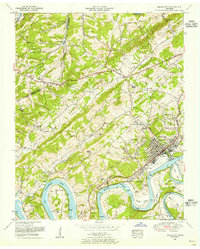
Other maps of this area

1895 · Loudon
USGS Topo · 1:125,000

1935 · Meadow
USGS Topo · 1:24,000

1935 · Lenoir City
USGS Topo · 1:24,000

1935 · Elverton
USGS Topo · 1:24,000

1935 · Bethel Valley
USGS Topo · 1:24,000

1935 · Philadelphia
USGS Topo · 1:24,000

1935 · Lovell
USGS Topo · 1:24,000

1936 · Cave Creek
USGS Topo · 1:24,000

1936 · Friendship
USGS Topo · 1:48,000

1936 · Loudon
USGS Topo · 1:24,000