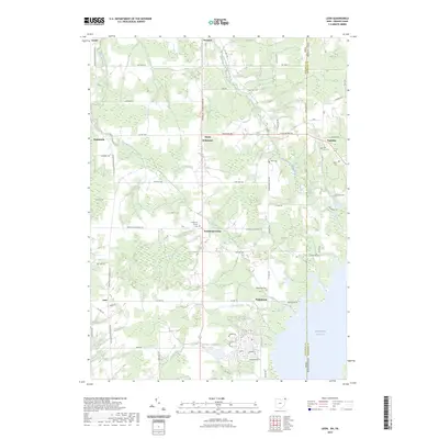
2023 Map of Leon
USGS Topo · Published 2023About this map
The West Branch Ashtabula River and East Branch Ashtabula River converge across a landscape defined by small rural hubs and the expansive waters of the Pymatuning Reservoir along the Ohio-Pennsylvania border. This survey details the transition from traditional farming hamlets like Richmond Center and North Richmond to modern recreational layouts, most notably the dense street grid of Holiday Camplands Lake. The area's settlement history is preserved in several small burial grounds, including Penn Line Cem and Barber Cem on the Pennsylvania side, and Padanaram Cem in Ohio. The presence of Gravel Run and numerous wetlands suggests a terrain historically shaped by drainage and agriculture, now balanced by the artificial shoreline of the reservoir.
Find a feature on this map
63 named features on this map. Tap any name to fly to it.
Don’t see what you’re looking for? This feature index may not catch every label — zoom into the map to look around manually.
Map Details
Editions of this 2023 Leon Map
This is the sole edition of this map. No revisions or reprints were ever made.
Other maps of this area

1900 · Girard
USGS Topo · 1:62,500

1905 · Andover
USGS Topo · 1:48,000

1906 · Conneaut
USGS Topo · 1:62,500

1906 · Linesville
USGS Topo · 1:62,500

1907 · Andover
USGS Topo · 1:62,500

1908 · Linesville
USGS Topo · 1:62,500

1950 · Cleveland
USGS Topo · 1:250,000

1956 · Cleveland
USGS Topo · 1:250,000

1959 · Hartstown
USGS Topo · 1:24,000

1959 · Beaver Center
USGS Topo · 1:24,000
Featured Places
- Cherry Valley Township, OH
- Pierpont Township, OH
- Dorset Township, OH
- Denmark Township, OH
- Richmond Township, OH