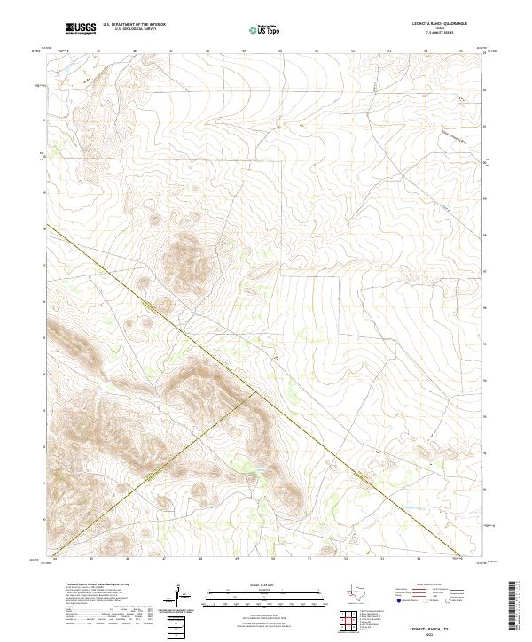
2022 Map of Leoncita Ranch
USGS Topo · Published 2022About this map
The high desert landscape of the Trans-Pecos converges where three counties—Pecos, Brewster, and Jeff Davis—meet at a single diagonal boundary line. This 2022 survey captures the hydrologic character of the Leoncita Spring area, where seasonal watercourses such as Limpia Cr and Musquiz Cr drain through the arid terrain. The presence of Upper Coyanosa Draw in the northeastern corner illustrates the complex drainage patterns typical of this part of West Texas. Historically significant as a ranching corridor, the map shows Hovey Rd traversing the eastern portion of the quadrangle, providing a modern connection through a region defined more by its natural topography than by permanent settlement.
Find a feature on this map
8 named features on this map. Tap any name to fly to it.
Don’t see what you’re looking for? This feature index may not catch every label — zoom into the map to look around manually.
Map Details
Editions of this 2022 Leoncita Ranch Map
This is the sole edition of this map. No revisions or reprints were ever made.
Other maps of this area

1894 · Fort Davis
USGS Topo · 1:125,000

1897 · Fort Davis
USGS Topo · 1:125,000

1929 · Hovey
USGS Topo · 1:125,000

1954 · Fort Stockton
USGS Topo · 1:250,000

1958 · Fort Stockton
USGS Topo · 1:250,000

1970 · Deep Well Ranch
USGS Topo · 1:24,000

1970 · Deep Well Ranch SE
USGS Topo · 1:24,000

1973 · Fort Stockton
USGS Topo · 1:250,000

1980 · Hovey
USGS Topo · 1:24,000
1980 · Barrilla Mountains East
USGS Topo · 1:24,000