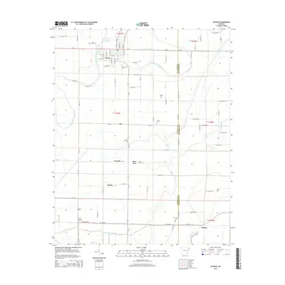
2014 Map of Lepanto
USGS Topo · Published 2014About this map
The town of Lepanto serves as the focal point of this Eastern Arkansas landscape, situated along the Left Hand Chute of Little River. The geography is defined by a dense network of drainage canals and meandering water bodies, including Ditch Number 51b and the Tyronza River further south. This region's agricultural and social fabric is revealed through small crossroads and settlements such as Alto, Whitton, and Dub, alongside industrial markers like Frys Mill. Genealogists will find significant value in the numerous burial sites distributed across the countryside, including Potter Memorial Cem, Greenwood Cem, and the Conaster Cem. The map illustrates the persistent intersection of water and land in the Delta, where features like Spear Lake and Cross Bayou punctuate the grid of county roads and state routes like Ar-135.
Find a feature on this map
84 named features on this map. Tap any name to fly to it.
Don’t see what you’re looking for? This feature index may not catch every label — zoom into the map to look around manually.
Map Details
Editions of this 2014 Lepanto Map
This is the sole edition of this map. No revisions or reprints were ever made.
Other maps of this area

1931 · Jericho
USGS Topo · 1:62,500

1939 · Jericho
USGS Topo · 1:62,500

1939 · Evadale
USGS Topo · 1:62,500

1940 · Deckerville
USGS Topo · 1:62,500

1941 · Marked Tree
USGS Topo · 1:62,500

1952 · Jericho
USGS Topo · 1:62,500

1953 · Memphis
USGS Topo · 1:250,000

1956 · Evadale
USGS Topo · 1:62,500

1956 · Marked Tree
USGS Topo · 1:62,500

1956 · Memphis
USGS Topo · 1:250,000