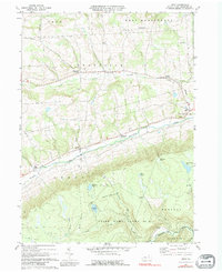
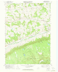
1969 Map of Leroy
USGS Topo · Published 1979About this map
Towanda Creek and its many tributaries, including the North Branch Towanda Creek, dictate the settlement patterns of this Bradford County landscape. During this era, small agricultural and crossroads communities like Granville Center, Bailey Corners, and Sayees Corners populate the northern plateaus. To the south, the terrain shifts significantly as it enters the State Game Lands No 12, where the high ground is dotted with upland water bodies such as Holcomb Pond, Sunfish Pond, and Mud Pond. The southern half of the map reveals a more industrial and isolated character, marked by the sites of Barclay, Carbon, and Laquin along Schrader Creek. These locations reflect the area’s history of resource extraction, further evidenced by a Sandpit near West Leroy and a Gravel Pit further east. The transition from the valley farms of Leroy to the high, wooded game lands illustrates the dual nature of the region's land use.
Find a feature on this map
37 named features on this map. Tap any name to fly to it.
Don’t see what you’re looking for? This feature index may not catch every label — zoom into the map to look around manually.
Map Details
Editions of this 1969 Leroy Map
2 editions found
Other maps of this area

1931 · Troy
USGS Topo · 1:48,000

1938 · Troy
USGS Topo · 1:62,500

1939 · Sayre
USGS Topo · 1:62,500

1942 · Sayre
USGS Topo · 1:62,500

1942 · Canton
USGS Topo · 1:62,500

1943 · Powell
USGS Topo · 1:62,500

1944 · Canton
USGS Topo · 1:62,500

1945 · Powell
USGS Topo · 1:62,500

1948 · Sayre
USGS Topo · 1:62,500

1954 · Williamsport
USGS Topo · 1:250,000
Featured Places
- West Burlington Township, PA
- Leroy Township, PA
- Overton Township, PA
- West Leroy, Leroy Township
- Vroman Hill, West Burlington Township