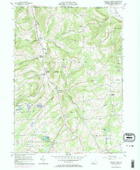
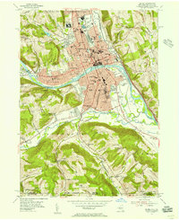
1957 Map of Bentley Creek
USGS Topo · Published 1983About this map
Bentley Creek flows northward through the heart of northern Bradford County, defining a valley that historically linked the southern Pennsylvania hill country to the New York state line. The settlement pattern here is dictated by the narrow drainage basins of Green Creek and Trout Creek, where small clusters like Middletown and Ridgebury established themselves away from the steeper ridges of Burnham Hill and East Canfield Mtn. Local education and faith are centered at landmarks such as the Township Sch and the Ridgebury Chapel, while the presence of the Bentley Creek Cem and Hanlon Hill Cem provides specific points of interest for genealogical research.
Find a feature on this map
47 named features on this map. Tap any name to fly to it.
Don’t see what you’re looking for? This feature index may not catch every label — zoom into the map to look around manually.
Map Details
Editions of this 1957 Bentley Creek Map
4 editions found
Other maps of this area

1895 · Elmira
USGS Topo · 1:62,500

1902 · Waverly
USGS Topo · 1:62,500

1905 · Watkins Glen
USGS Topo · 1:125,000

1931 · Troy
USGS Topo · 1:48,000

1938 · Troy
USGS Topo · 1:62,500

1939 · Sayre
USGS Topo · 1:62,500

1942 · Sayre
USGS Topo · 1:62,500

1948 · Sayre
USGS Topo · 1:62,500

1950 · Elmira
USGS Topo · 1:250,000
1953 · Elmira
USGS Topo · 1:24,000
Featured Places
- Springfield Township, PA
- South Creek Township, PA
- Big Pond, Springfield Township
- Bentley Creek, Ridgebury Township
- Smithfield Township, PA