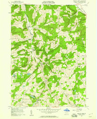
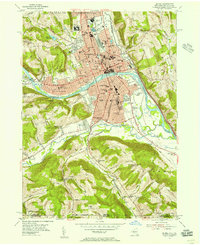
1957 Map of Bentley Creek
USGS Topo · Published 1958About this map
Bentley Creek and its surrounding highlands in northern Bradford County define this landscape along the New York border during the late 1950s. The valley floor serves as the primary corridor for settlement, linking Ridgebury and Middletown through a network of small farms and family-named landmarks. The topography is dominated by significant elevations such as Hanlon Hill and Butler Hill, which separate the various creek branches.
Find a feature on this map
40 named features on this map. Tap any name to fly to it.
Don’t see what you’re looking for? This feature index may not catch every label — zoom into the map to look around manually.
Map Details
Editions of this 1957 Bentley Creek Map
4 editions found
Other maps of this area

1895 · Elmira
USGS Topo · 1:62,500

1902 · Waverly
USGS Topo · 1:62,500

1905 · Watkins Glen
USGS Topo · 1:125,000

1931 · Troy
USGS Topo · 1:48,000

1938 · Troy
USGS Topo · 1:62,500

1939 · Sayre
USGS Topo · 1:62,500

1942 · Sayre
USGS Topo · 1:62,500

1948 · Sayre
USGS Topo · 1:62,500

1950 · Elmira
USGS Topo · 1:250,000
1953 · Elmira
USGS Topo · 1:24,000
Featured Places
- Springfield Township, PA
- South Creek Township, PA
- Big Pond, Springfield Township
- Bentley Creek, Ridgebury Township
- Smithfield Township, PA