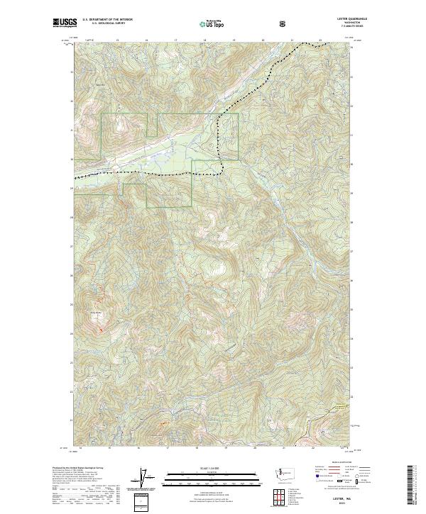
2023 Map of Lester
USGS Topo · Published 2023About this map
Snoqualmie National Forest dominates this landscape in the eastern reaches of King County, where the upper Green River carves through high terrain. The settlement of Lester serves as a primary point of reference in a region defined by its complex network of watercourses and forest service access roads. Numerous drainages, including Sunday Creek, Friday Creek, and Sawmill Creek, feed into the river from the steep slopes of Bald Mtn and Kelly Butte.
Find a feature on this map
45 named features on this map. Tap any name to fly to it.
Don’t see what you’re looking for? This feature index may not catch every label — zoom into the map to look around manually.
Map Details
Editions of this 2023 Lester Map
This is the sole edition of this map. No revisions or reprints were ever made.
Other maps of this area

1901 · Snoqualmie Pass
USGS Topo · 1:125,000

1903 · Snoqualmie
USGS Topo · 1:125,000

1913 · Cedar Lake
USGS Topo · 1:125,000

1956 · Greenwater
USGS Topo · 1:62,500

1957 · Wenatchee
USGS Topo · 1:250,000

1960 · Bandera
USGS Topo · 1:62,500

1961 · Snoqualmie Pass
USGS Topo · 1:62,500

1962 · Lester
USGS Topo · 1:62,500

1975 · Snoqualmie Pass
USGS Topo · 1:100,000
1986 · Nagrom
USGS Topo · 1:24,000