
1956 Map of Letitia
USGS Topo · Published 1959About this map
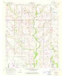
Beaver Creek carves a winding path through this corner of Oklahoma, where the boundaries of Comanche, Cotton, and Stephens counties converge. Recorded in the mid-1950s, the landscape reveals a distribution of rural social centers including the Pleasant Valley Community House and several local schools such as Ash Grove School and Messing School. The settlement at Letitia is accompanied by a nearby Cem, providing a valuable reference for family history researchers tracing early residents in this agricultural district. Small-scale industrial activity is evident in the northern sections, where oil wells and slush tanks appear alongside the drainage of Armstrong Creek. From the crossroads at Pumpkin Center to the southern reach of Hulen, the map captures a rural community structured by established section lines and the vital watercourse of the creek system.
Find a feature on this map
27 named features on this map. Tap any name to fly to it.
Don’t see what you’re looking for? This feature index may not catch every label — zoom into the map to look around manually.
Map Details
Editions of this 1956 Letitia Map
2 editions found
Other maps of this area

1946 · Lawton
USGS Topo · 1:62,500

1949 · Arbuckle Hill
USGS Topo · 1:24,000

1949 · Nellie
USGS Topo · 1:62,500

1955 · Lawton
USGS Topo · 1:250,000

1956 · Sterling
USGS Topo · 1:24,000

1956 · Ninemile Creek
USGS Topo · 1:24,000

1956 · Arbuckle Hill
USGS Topo · 1:24,000
1956 · Denton
USGS Topo · 1:24,000

1956 · Nellie
USGS Topo · 1:24,000

1956 · Lawton
USGS Topo · 1:62,500