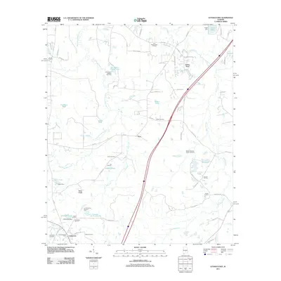
2011 Map of Letohatchee
USGS Topo · Published 2011About this map
The settlement of Letohatchee anchors this Lowndes County landscape, situated where the drainage of Steep Creek and Jack Creek defines the terrain. The presence of the Letohatchee Post Office and numerous family-named burial grounds, such as Relf Cemetery and Mosleys Cemetery, reflects a deeply rooted rural community structure. Interstate 65 bisects the region, creating a stark contrast between modern transportation corridors and the older network of county roads like Co RD 37 and Co RD 26. Small-scale water management is a defining characteristic of the area, evidenced by a high density of private ponds and dams, including Rogers Dam and C P Crenshaw Dam. Further north, the communities of Tyson and Rolling Acres sit among the headwaters of Pintlala Creek, where the land maintains its traditional agricultural and residential character into the 21st century.
Find a feature on this map
74 named features on this map. Tap any name to fly to it.
Don’t see what you’re looking for? This feature index may not catch every label — zoom into the map to look around manually.
Map Details
Editions of this 2011 Letohatchee Map
This is the sole edition of this map. No revisions or reprints were ever made.
Other maps of this area

1927 · Montgomery
USGS Topo · 1:48,000

1930 · Montgomery
USGS Topo · 1:62,500

1953 · Montgomery
USGS Topo · 1:250,000

1956 · Montgomery
USGS Topo · 1:250,000

1957 · Montgomery
USGS Topo · 1:250,000

1957 · Letohatchee
USGS Topo · 1:62,500

1957 · Autaugaville
USGS Topo · 1:62,500

1958 · Montgomery
USGS Topo · 1:62,500

1958 · Montgomery South
USGS Topo · 1:24,000

1975 · Autaugaville SE
USGS Topo · 1:24,000