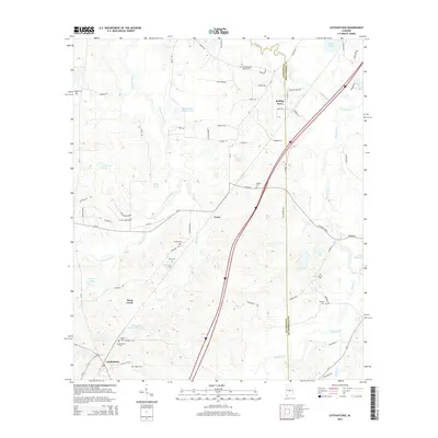
2014 Map of Letohatchee
USGS Topo · Published 2014About this map
Letohatchee anchors the southwestern corner of this survey, situated where the terrain begins to rise toward Oak Ridge Ln. The landscape is defined by the complex drainage systems of Pintlala Creek and Pinchony Creek, which wind through a patchwork of family-named water bodies such as Lila Rebecca Webster Lake and J L Crenshaw Lake Number One. This area along the boundary of Lowndes and Montgomery counties maintains a distinct rural character, with small settlements like Tyson and Rolling Acres connected by a network of county roads. For genealogists, the map is particularly valuable for its documentation of numerous small burial sites, including Relf Cemetery and Powell Cemetery, which are scattered among the ridges and creek prongs, often located near private farm tracks like Owen Farm Road.
Find a feature on this map
76 named features on this map. Tap any name to fly to it.
Don’t see what you’re looking for? This feature index may not catch every label — zoom into the map to look around manually.
Map Details
Editions of this 2014 Letohatchee Map
This is the sole edition of this map. No revisions or reprints were ever made.
Other maps of this area

1927 · Montgomery
USGS Topo · 1:48,000

1930 · Montgomery
USGS Topo · 1:62,500

1953 · Montgomery
USGS Topo · 1:250,000

1956 · Montgomery
USGS Topo · 1:250,000

1957 · Montgomery
USGS Topo · 1:250,000

1957 · Letohatchee
USGS Topo · 1:62,500

1957 · Autaugaville
USGS Topo · 1:62,500

1958 · Montgomery
USGS Topo · 1:62,500

1958 · Montgomery South
USGS Topo · 1:24,000

1975 · Autaugaville SE
USGS Topo · 1:24,000