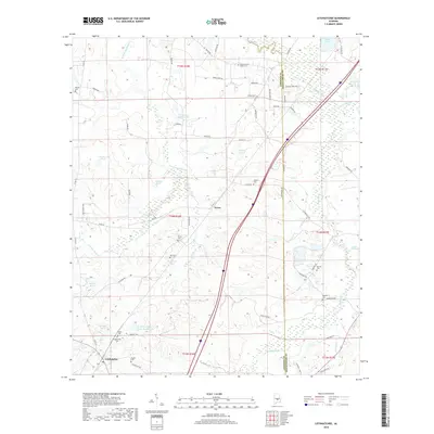
2018 Map of Letohatchee
USGS Topo · Published 2018About this map
Letohatchee serves as a primary reference point in this south-central Alabama landscape, situated near the headwaters of Jack Creek. The terrain is defined by a dense network of family-named water features and rural cemeteries, reflecting a long-established agricultural community. Small settlements like Tyson are connected by a web of named country roads such as Chicken Pit Rd and Old Rd. Local genealogy is particularly well-represented here, with numerous burial grounds including Letohatchee Cem, Beulah Cem, and New Pleasant Valley Cem scattered across the township lines of Lowndes and Montgomery counties. Notable landmarks such as Lila Rebecca Webster Lake and J L Crenshaw Lake Number One suggest a history of private land management and local hydrography that remains central to the character of the area into the late 2010s.
Find a feature on this map
72 named features on this map. Tap any name to fly to it.
Don’t see what you’re looking for? This feature index may not catch every label — zoom into the map to look around manually.
Map Details
Editions of this 2018 Letohatchee Map
This is the sole edition of this map. No revisions or reprints were ever made.
Other maps of this area

1927 · Montgomery
USGS Topo · 1:48,000

1930 · Montgomery
USGS Topo · 1:62,500

1953 · Montgomery
USGS Topo · 1:250,000

1956 · Montgomery
USGS Topo · 1:250,000

1957 · Montgomery
USGS Topo · 1:250,000

1957 · Letohatchee
USGS Topo · 1:62,500

1957 · Autaugaville
USGS Topo · 1:62,500

1958 · Montgomery
USGS Topo · 1:62,500

1958 · Montgomery South
USGS Topo · 1:24,000

1975 · Autaugaville SE
USGS Topo · 1:24,000