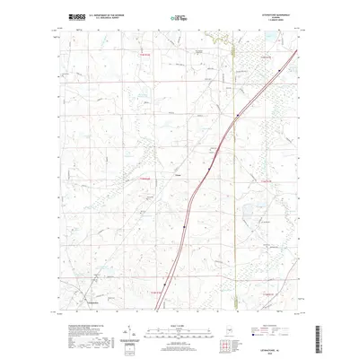
2020 Map of Letohatchee
USGS Topo · Published 2020About this map
Letohatchee sits in the southwestern corner of this Lowndes County survey, serving as a focal point for a landscape defined by small-scale agriculture and private water features. The terrain is marked by a complex network of streams including N Prong Steep Cr, Pintlala Creek, and Pinchony Cr which feed numerous family-named impoundments such as Crenshaws Pond and Judges Pond. Genealogists will find a high density of burial sites scattered across the rural acreage, from the Letohatchee Cem near the town center to more isolated locations like Powell Cem, Relf Cem, and New Pleasant Valley Cem. The settlement at Tyson anchors the central part of the sheet, where modern transit corridors like Interstate 65 now intersect older thoroughfares like Federal Rd, reflecting the gradual evolution of South Alabama transport from historic paths to high-speed highways.
Find a feature on this map
69 named features on this map. Tap any name to fly to it.
Don’t see what you’re looking for? This feature index may not catch every label — zoom into the map to look around manually.
Map Details
Editions of this 2020 Letohatchee Map
This is the sole edition of this map. No revisions or reprints were ever made.
Other maps of this area

1927 · Montgomery
USGS Topo · 1:48,000

1930 · Montgomery
USGS Topo · 1:62,500

1953 · Montgomery
USGS Topo · 1:250,000

1956 · Montgomery
USGS Topo · 1:250,000

1957 · Montgomery
USGS Topo · 1:250,000

1957 · Letohatchee
USGS Topo · 1:62,500

1957 · Autaugaville
USGS Topo · 1:62,500

1958 · Montgomery
USGS Topo · 1:62,500

1958 · Montgomery South
USGS Topo · 1:24,000

1975 · Autaugaville SE
USGS Topo · 1:24,000