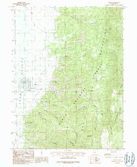
1983 Map of Levan
USGS Topo · Published 1983About this map
The settlement of Levan sits at the eastern edge of the Juab Valley, positioned where the canyon waters emerge from the towering San Pitch Mountains. This 1983 survey shows a landscape defined by the sharp transition from irrigated valley floors to the protected slopes of the Uinta National Forest. The map documents the local economy through its extractive sites, including multiple Quarries, a Quarry, and Gravel Pits located near the town and along the base of the foothills. Hydrology is a dominant feature, with numerous drainages like Chicken Creek, Pigeon Creek, and Fourmile Creek carving deep paths through the highlands. High-altitude landmarks such as Levan Peak and Horse Heaven Mountain overlook a complex system of named hollows, including Water Hollow and Trough Spring Hollow, illustrating how water sources dictated the naming and usage of this high Utah terrain.
Find a feature on this map
33 named features on this map. Tap any name to fly to it.
Don’t see what you’re looking for? This feature index may not catch every label — zoom into the map to look around manually.
Map Details
Editions of this 1983 Levan Map
This is the sole edition of this map. No revisions or reprints were ever made.
Other maps of this area

1885 · Manti
USGS Topo · 1:250,000

1895 · Manti
USGS Topo · 1:250,000

1951 · Moroni
USGS Topo · 1:62,500

1951 · Nephi
USGS Topo · 1:62,500

1956 · Price
USGS Topo · 1:250,000

1960 · Price
USGS Topo · 1:250,000

1962 · Price
USGS Topo · 1:250,000

1965 · Chriss Canyon
USGS Topo · 1:24,000
1965 · Skinner Peaks
USGS Topo · 1:24,000

1965 · Wales
USGS Topo · 1:24,000