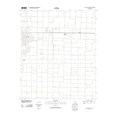
2010 Map of Levelland East
USGS Topo · Published 2010About this map
Leveland serves as the focal point of this South Plains landscape, where the town's residential and industrial grid transitions into a vast network of section roads. The settlement patterns at Opdyke West and Opdyke reflect the region's mid-century expansion along the highway, while the Levelland Municipal Airport anchors the western edge of the quadrangle. A unique naming convention for the east-west roads emerges south of the town center, where thoroughfares are named for animals, including Bear Rd, Coyote Rd, Bison, and Greyhound Rd. These straight-line roads, such as Alamo Rd and Concho Rd, highlight the systematic agricultural division of Hockley County. The landscape is characterized by numerous small playa basins, which dot the plains between the established homesteads and irrigated fields.
Find a feature on this map
41 named features on this map. Tap any name to fly to it.
Don’t see what you’re looking for? This feature index may not catch every label — zoom into the map to look around manually.
Map Details
Editions of this 2010 Levelland East Map
This is the sole edition of this map. No revisions or reprints were ever made.
Other maps of this area

1954 · Brownfield
USGS Topo · 1:250,000

1957 · Meadow
USGS Topo · 1:62,500

1957 · Wolfforth
USGS Topo · 1:62,500

1958 · Brownfield
USGS Topo · 1:250,000

1962 · Brownfield
USGS Topo · 1:250,000

1964 · Whitharral
USGS Topo · 1:24,000

1965 · Levelland West
USGS Topo · 1:24,000

1965 · Sundown
USGS Topo · 1:24,000

1965 · Levelland East
USGS Topo · 1:24,000

1965 · Hester Ranch
USGS Topo · 1:24,000