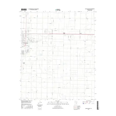
2016 Map of Levelland East
USGS Topo · Published 2016About this map
Levelland anchors the western edge of this High Plains landscape, where the street grid of the eastern city limits meets the vast agricultural reaches of Hockley County. The transition from urban center to rural expanse is marked by educational and infrastructure hubs, notably the campus of S Plains Coll and the Levelland Municipal Airport. The landscape is defined by a rigorous surveyor's grid, punctuated by small clusters of community life at Opdyke West and Opdyke along the northern rail corridor. This 2016 survey illustrates a modern rural-industrial pattern, where residential developments like Country Club Ln and Tanglewood Ln sit adjacent to working fields. The named roads, such as America Rd and Alaska Rd, reveal the systematic organization of the Texas Panhandle's cotton and ranching country.
Find a feature on this map
89 named features on this map. Tap any name to fly to it.
Don’t see what you’re looking for? This feature index may not catch every label — zoom into the map to look around manually.
Map Details
Editions of this 2016 Levelland East Map
This is the sole edition of this map. No revisions or reprints were ever made.
Other maps of this area

1954 · Brownfield
USGS Topo · 1:250,000

1957 · Meadow
USGS Topo · 1:62,500

1957 · Wolfforth
USGS Topo · 1:62,500

1958 · Brownfield
USGS Topo · 1:250,000

1962 · Brownfield
USGS Topo · 1:250,000

1964 · Whitharral
USGS Topo · 1:24,000

1965 · Levelland West
USGS Topo · 1:24,000

1965 · Sundown
USGS Topo · 1:24,000

1965 · Levelland East
USGS Topo · 1:24,000

1965 · Hester Ranch
USGS Topo · 1:24,000