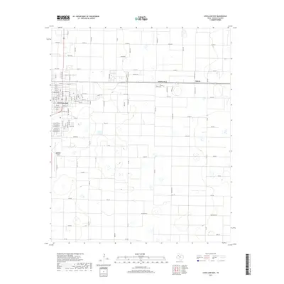
2019 Map of Levelland East
USGS Topo · Published 2019About this map
The High Plains city of Levelland serves as a major hub on this 2019 survey, showcasing the transition from concentrated urban street grids to the expansive agricultural blocks of the Llano Estacado. The landscape is defined by a rigorous cardinal grid, with long straight corridors such as FM 2646 and FM 3261 connecting outlying communities like Opdyke West and Opdyke. The importance of local aviation is evident at the Levelland Municipal Airport, while the nomenclature of the rural roads — including Deer Rd, Elk Rd, and Greyhound Rd — hints at the wildlife and ranching culture of Hockley County. Dozens of small, seasonal playa lakes dot the terrain between the large-scale cotton and grain operations that dominate this portion of the Texas Panhandle.
Find a feature on this map
25 named features on this map. Tap any name to fly to it.
Don’t see what you’re looking for? This feature index may not catch every label — zoom into the map to look around manually.
Map Details
Editions of this 2019 Levelland East Map
This is the sole edition of this map. No revisions or reprints were ever made.
Other maps of this area

1954 · Brownfield
USGS Topo · 1:250,000

1957 · Meadow
USGS Topo · 1:62,500

1957 · Wolfforth
USGS Topo · 1:62,500

1958 · Brownfield
USGS Topo · 1:250,000

1962 · Brownfield
USGS Topo · 1:250,000

1964 · Whitharral
USGS Topo · 1:24,000

1965 · Levelland West
USGS Topo · 1:24,000

1965 · Sundown
USGS Topo · 1:24,000

1965 · Levelland East
USGS Topo · 1:24,000

1965 · Hester Ranch
USGS Topo · 1:24,000