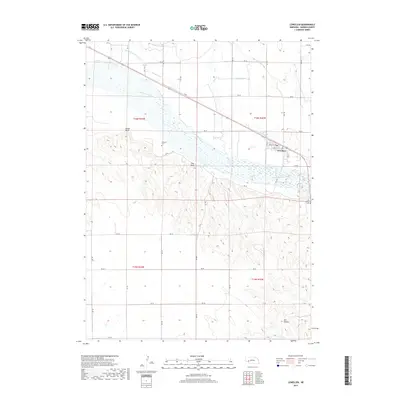
2017 Map of Lewellen
USGS Topo · Published 2017About this map
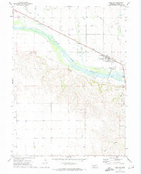
Lewellen sits at the northern edge of the North Platte River valley, serving as a hub for the intricate irrigation networks that define this portion of Garden County. The landscape is characterized by a sophisticated system of water management, including the Midland Overland Canal, Union Canal, and Graf Canal, which terrace the land above the river. To the south, the terrain rises sharply into the bluffs and canyons of the Ash Hollow area, a location of significant transit for early travelers. Local history and genealogy are anchored by landmarks such as Durham Cem and the Ash Hollow Cem, while natural features like Signal Bluff and Clay Peak provide prominent navigational points above the irrigated plains. The map illustrates the juxtaposition of engineered waterways and the river's braided channels against the complex topography of the southern breaks.
Find a feature on this map
44 named features on this map. Tap any name to fly to it.
Don’t see what you’re looking for? This feature index may not catch every label — zoom into the map to look around manually.
Map Details
Editions of this 2017 Lewellen Map
This is the sole edition of this map. No revisions or reprints were ever made.
Other maps of this area

1900 · Chappell
USGS Topo · 1:125,000

1954 · Scottsbluff
USGS Topo · 1:250,000

1958 · Scottsbluff
USGS Topo · 1:250,000
1971 · Twin Buttes
USGS Topo · 1:24,000
1971 · Big Springs NE
USGS Topo · 1:24,000
1971 · Ruthton
USGS Topo · 1:24,000

1971 · Barn Butte
USGS Topo · 1:24,000

1971 · Chappell NE
USGS Topo · 1:24,000
1971 · Old Baldy
USGS Topo · 1:24,000
1971 · Lewellen
USGS Topo · 1:24,000