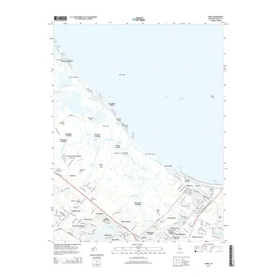
2014 Map of Lewes
USGS Topo · Published 2014About this map
Lewes serves as the focal point of this Delaware coastal landscape, where the Lewes and Rehoboth Canal meets the maritime activity of Breakwater Harbor. The 2014 survey reveals a complex network of wetlands and tidal reaches, including No Mans Friend Reach and Flatland Reach along the Broadkill River. This area is characterized by its transition from established inland settlements like Nassau and Overbrook to the thin barrier islands of Beach Plum Island and Broadkill Beach.
Find a feature on this map
164 named features on this map. Tap any name to fly to it.
Don’t see what you’re looking for? This feature index may not catch every label — zoom into the map to look around manually.
Map Details
Editions of this 2014 Lewes Map
This is the sole edition of this map. No revisions or reprints were ever made.
Other maps of this area

1917 · Millsboro
USGS Topo · 1:62,500

1918 · Cedar Creek
USGS Topo · 1:62,500

1918 · Rehoboth
USGS Topo · 1:62,500

1918 · Cape Henlopen
USGS Topo · 1:62,500

1919 · Cedar Creek
USGS Topo · 1:62,500

1937 · Cape Henlopen
USGS Topo · 1:62,500

1938 · Cedar Creek
USGS Topo · 1:62,500

1938 · Millsboro
USGS Topo · 1:62,500

1938 · Rehoboth
USGS Topo · 1:62,500

1943 · Fairmount
USGS Topo · 1:24,000