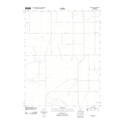
2010 Map of Lewis Lake
USGS Topo · Published 2010About this map
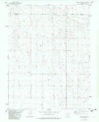
Lewis Lake lies at the heart of this high plains landscape in eastern Colorado, serving as a prominent landmark in an area defined by wide-reaching drainage systems and a strict section-line road grid. The map document traces the winding paths of Big Sandy Creek in the northeast and Rush Creek across the southern half, showing the natural hydrologic patterns that break up the geometric precision of the rural infrastructure. This 2010 survey details the extensive network of local thoroughfares, from County Road L at the northern boundary to County Road B in the south. The layout of these routes, including County Rd 18 and County Rd 22, reflects the enduring agricultural organization of Cheyenne County, where property lines and travel corridors remain closely tied to the original land surveys of the American West.
Find a feature on this map
18 named features on this map. Tap any name to fly to it.
Don’t see what you’re looking for? This feature index may not catch every label — zoom into the map to look around manually.
Map Details
Editions of this 2010 Lewis Lake Map
This is the sole edition of this map. No revisions or reprints were ever made.
Other maps of this area

1891 · Kit Carson
USGS Topo · 1:125,000

1893 · Kit Carson
USGS Topo · 1:125,000

1954 · Lamar
USGS Topo · 1:250,000

1958 · Lamar
USGS Topo · 1:250,000

1981 · Cheyenne Wells
USGS Topo · 1:100,000
1982 · Sorrento
USGS Topo · 1:24,000
1982 · Kit Carson
USGS Topo · 1:24,000

1982 · Kit Carson 4 NW
USGS Topo · 1:24,000
1982 · Arsenic Lake
USGS Topo · 1:24,000
1982 · Dunlap Ranch
USGS Topo · 1:24,000