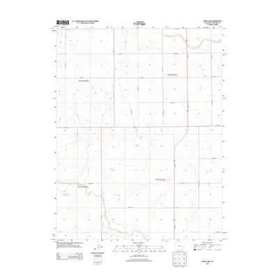
2013 Map of Lewis Lake
USGS Topo · Published 2013About this map
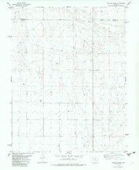
Big Sandy Cr and Rush Creek carve through the high plains of Cheyenne County, revealing a landscape defined by seasonal water and the rigid geometry of the Public Land Survey System. The area is marked by several small, isolated water bodies, including Lewis Lake and Skank Lake, which served as critical landmarks in an otherwise open terrain. In the southwestern quadrant, the State Stock Reservoir Number 7 highlights the importance of water management for local ranching and livestock operations. This survey illustrates the 21st-century rural infrastructure of eastern Colorado, where the north-south artery of Us-287 N intersects a strictly partitioned grid of county roads, such as Co Road G and Co Road J, that facilitated access to remote agricultural sections.
Find a feature on this map
25 named features on this map. Tap any name to fly to it.
Don’t see what you’re looking for? This feature index may not catch every label — zoom into the map to look around manually.
Map Details
Editions of this 2013 Lewis Lake Map
This is the sole edition of this map. No revisions or reprints were ever made.
Other maps of this area

1891 · Kit Carson
USGS Topo · 1:125,000

1893 · Kit Carson
USGS Topo · 1:125,000

1954 · Lamar
USGS Topo · 1:250,000

1958 · Lamar
USGS Topo · 1:250,000

1981 · Cheyenne Wells
USGS Topo · 1:100,000
1982 · Sorrento
USGS Topo · 1:24,000
1982 · Kit Carson
USGS Topo · 1:24,000

1982 · Kit Carson 4 NW
USGS Topo · 1:24,000
1982 · Arsenic Lake
USGS Topo · 1:24,000
1982 · Dunlap Ranch
USGS Topo · 1:24,000