1970 Map of Lewisburg
USGS Topo · Published 1980About this map
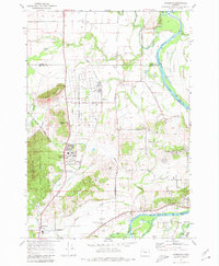
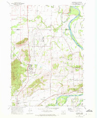
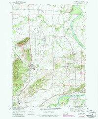
Adair Air Force Station dominates the central landscape of this 1970 survey, reflecting the military presence that shaped this part of Benton County. The area is a complex patchwork of conservation and infrastructure, featuring the E E Wilson Game Management Area alongside the research facilities of the Oregon State Univ Test Field Lab. Local life centers around small historic clusters like Wellsdale, Palestine, and Lewisburg, where the Palestine Church and Gingles Cem serve as long-standing community landmarks. The transport geography is defined by the Southern Pacific and Oregon Electric railroads, which parallel the Willamette River and its various sloughs. From the heights of Logsden Ridge and Coffin Butte to the lowland bends of the Luckiamute River, the map captures a transition from upland timber to the fertile agriculture of the valley floor.
Find a feature on this map
59 named features on this map. Tap any name to fly to it.
Don’t see what you’re looking for? This feature index may not catch every label — zoom into the map to look around manually.
Map Details
Editions of this 1970 Lewisburg Map
3 editions found
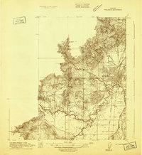
Other maps of this area

1911 · Tangent
USGS Topo · 1:31,680

1912 · Jefferson
USGS Topo · 1:31,680
1913 · Philomath
USGS Topo · 1:31,680

1913 · Oakville
USGS Topo · 1:31,680

1913 · Wells
USGS Topo · 1:31,680

1914 · Independence
USGS Topo · 1:31,680

1914 · Soap Creek
USGS Topo · 1:31,680

1915 · Sidney
USGS Topo · 1:31,680

1916 · Albany
USGS Topo · 1:62,500

1917 · Salem
USGS Topo · 1:62,500