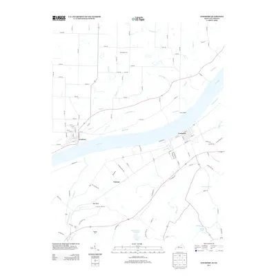
2013 Map of Lewisport
USGS Topo · Published 2013About this map
Lewisport, Kentucky, and Grandview, Indiana, face each other across a wide stretch of the Ohio River in this detailed survey. The river's influence is evident in the low-lying terrain of Corn Island and the expansive Big Slough, while the Kentucky side rises toward elevations like Gentry Hill and Shaw Bluff. The settlement pattern follows the riverbank and inland routes, with Waitman serving as a primary point between the hills and the bottomlands. Genealogists will find several burial sites noted, including Old Sergeant Cem north of the river and Sand Hill Cem near Lewisport. The presence of Fish and Game Farm Lake and Sunnys Lake further south points to the managed water and recreational landscape of Hancock County during the early 21st century.
Find a feature on this map
95 named features on this map. Tap any name to fly to it.
Don’t see what you’re looking for? This feature index may not catch every label — zoom into the map to look around manually.
Map Details
Editions of this 2013 Lewisport Map
This is the sole edition of this map. No revisions or reprints were ever made.
Other maps of this area

1900 · St Meinrad
USGS Topo · 1:62,500

1900 · De Gonia Springs
USGS Topo · 1:62,500

1901 · Owensboro
USGS Topo · 1:62,500

1902 · Ditney
USGS Topo · 1:125,000

1902 · Degonia Springs
USGS Topo · 1:62,500

1903 · St. Meinrad
USGS Topo · 1:62,500

1903 · Tell City
USGS Topo · 1:62,500

1952 · Owensboro East
USGS Topo · 1:24,000

1952 · Rockport
USGS Topo · 1:24,000

1953 · Lewisport
USGS Topo · 1:24,000