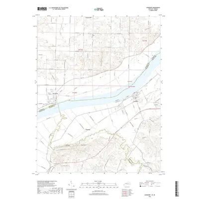
2019 Map of Lewisport
USGS Topo · Published 2019About this map
The Ohio River serves as the central artery and state boundary for this region, dividing Spencer County, Indiana, from Hancock and Daviess Counties in Kentucky. Along the southern bank, the town of Lewisport is a primary hub, while Waitman and Sand Hill mark the rural landscape to its west and south. The terrain here transitions from the wide river bottomlands to more varied elevations, including named high points such as Gentry Hill, Shaw Bluff, and the uniquely named Hogg Heaven.
Find a feature on this map
65 named features on this map. Tap any name to fly to it.
Don’t see what you’re looking for? This feature index may not catch every label — zoom into the map to look around manually.
Map Details
Editions of this 2019 Lewisport Map
This is the sole edition of this map. No revisions or reprints were ever made.
Other maps of this area

1900 · St Meinrad
USGS Topo · 1:62,500

1900 · De Gonia Springs
USGS Topo · 1:62,500

1901 · Owensboro
USGS Topo · 1:62,500

1902 · Ditney
USGS Topo · 1:125,000

1902 · Degonia Springs
USGS Topo · 1:62,500

1903 · St. Meinrad
USGS Topo · 1:62,500

1903 · Tell City
USGS Topo · 1:62,500

1952 · Owensboro East
USGS Topo · 1:24,000

1952 · Rockport
USGS Topo · 1:24,000

1953 · Lewisport
USGS Topo · 1:24,000