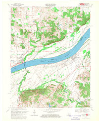
1967 Map of Lewisport
USGS Topo · Published 1969About this map
The Ohio River serves as a wide natural divider between the states of Indiana and Kentucky, with the town of Lewisport situated on the southern bank in Hancock County. This 1960s survey documents a landscape defined by its waterways, where large drainage systems like Blackford Creek and Yellow Creek wind through the bottomlands before meeting the main channel. Agricultural patterns and rural infrastructure are clearly delineated, showing a network of secondary roads such as Lee Henderson Road and Upper River Road that connect isolated farmsteads and rural landmarks.
Find a feature on this map
43 named features on this map. Tap any name to fly to it.
Don’t see what you’re looking for? This feature index may not catch every label — zoom into the map to look around manually.
Map Details
Editions of this 1967 Lewisport Map
This is the sole edition of this map. No revisions or reprints were ever made.
Other maps of this area

1900 · St Meinrad
USGS Topo · 1:62,500

1900 · De Gonia Springs
USGS Topo · 1:62,500

1901 · Owensboro
USGS Topo · 1:62,500

1902 · Ditney
USGS Topo · 1:125,000

1902 · Degonia Springs
USGS Topo · 1:62,500

1903 · St. Meinrad
USGS Topo · 1:62,500

1903 · Tell City
USGS Topo · 1:62,500

1952 · Owensboro East
USGS Topo · 1:24,000

1952 · Rockport
USGS Topo · 1:24,000

1953 · Lewisport
USGS Topo · 1:24,000