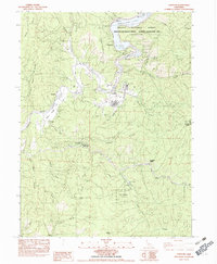
1982 Map of Lewiston
USGS Topo · Published 1982About this map
The Trinity River winds through the heart of this landscape, its waters controlled by the damming of Lewiston Lake in the early 1980s. This survey captures a specific era of resource management and local transition, highlighting the Trinity River Fish Hatchery and the expansive boundaries of the Ellen Pickett State Forest. Small settlements and named ranches such as Lowden Ranch and Bucktail dot the riverbanks, while the historic mining legacy of the region is evidenced by the Venecia Mine and French Mine.
Find a feature on this map
47 named features on this map. Tap any name to fly to it.
Don’t see what you’re looking for? This feature index may not catch every label — zoom into the map to look around manually.
Map Details
Editions of this 1982 Lewiston Map
2 editions found
Other maps of this area

1890 · Red Bluff
USGS Topo · 1:250,000

1894 · Red Bluff
USGS Topo · 1:250,000

1913 · Weaverville
USGS Topo · 1:125,000

1944 · French Gulch
USGS Topo · 1:62,500

1948 · French Gulch
USGS Topo · 1:62,500

1950 · Minersville
USGS Topo · 1:62,500

1950 · Schell Mtn
USGS Topo · 1:62,500

1950 · Weaverville
USGS Topo · 1:62,500
1952 · Schell Mtn.
USGS Topo · 1:62,500

1952 · Weaverville
USGS Topo · 1:62,500