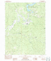
1982 Map of Lewiston
USGS Topo · Published 1985About this map
Lewiston serves as the focal point of this northern California landscape, situated along a sharp bend of the Trinity River. The river's flow is significantly managed by the Top Dam Spillway and Lewiston Dam, which together form Lewiston Lake within the Whiskeytown-Shasta-Trinity National Recreation Area. This water management infrastructure is closely tied to the Trinity River Fish Hatchery, located just downstream from the dam.
Find a feature on this map
46 named features on this map. Tap any name to fly to it.
Don’t see what you’re looking for? This feature index may not catch every label — zoom into the map to look around manually.
Map Details
Editions of this 1982 Lewiston Map
2 editions found
Other maps of this area

1890 · Red Bluff
USGS Topo · 1:250,000

1894 · Red Bluff
USGS Topo · 1:250,000

1913 · Weaverville
USGS Topo · 1:125,000

1944 · French Gulch
USGS Topo · 1:62,500

1948 · French Gulch
USGS Topo · 1:62,500

1950 · Minersville
USGS Topo · 1:62,500

1950 · Schell Mtn
USGS Topo · 1:62,500

1950 · Weaverville
USGS Topo · 1:62,500
1952 · Schell Mtn.
USGS Topo · 1:62,500

1952 · Weaverville
USGS Topo · 1:62,500