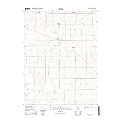
2014 Map of Lewistown
USGS Topo · Published 2014About this map
Lewistown serves as the central hub of this Lewis County landscape, where the local street grid meets the City of Lewistown Reservoir and the rural reaches of New Court Village. The terrain is defined by a dense network of meandering waterways, including the Middle Fabius River in the north and several branches of Grassy Cr and Little Grassy Cr further south. These drainage patterns influenced the placement of early infrastructure, from the small Prim Cemetery in the southeast to the Sharpe Farms Airport near Troublesome Cr. The 2014 survey reflects a well-established agrarian layout, marked by a precise grid of county roads such as Dogwood Ave and Cypress Ave that divide the various townships. Local history is preserved in these specific landmarks and family-named features like Sharpe Lake and Geisendorfer Lake, which illustrate the community's long-term relationship with its water resources.
Find a feature on this map
57 named features on this map. Tap any name to fly to it.
Don’t see what you’re looking for? This feature index may not catch every label — zoom into the map to look around manually.
Map Details
Editions of this 2014 Lewistown Map
This is the sole edition of this map. No revisions or reprints were ever made.
Other maps of this area

1903 · Kahoka
USGS Topo · 1:125,000

1903 · Palmyra
USGS Topo · 1:125,000

1948 · Quincy
USGS Topo · 1:250,000

1949 · Durham
USGS Topo · 1:24,000

1950 · Durham
USGS Topo · 1:24,000

1950 · Benjamin
USGS Topo · 1:24,000

1950 · Williamstown
USGS Topo · 1:24,000

1950 · Lewistown
USGS Topo · 1:24,000
1950 · Monticello
USGS Topo · 1:24,000

1950 · La Belle
USGS Topo · 1:24,000