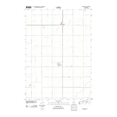
2010 Map of Lewisville
USGS Topo · Published 2010About this map
The agricultural landscape surrounding Lewisville is defined by a grid of county highways and township roads that organize the fertile plains of Watonwan County. At the heart of the community, the Lewisville Post Office serves as a central landmark within the compact town site. Outside the village, the land is etched by the winding paths of Perch Creek, Spring Branch Creek, and Spring Brook, which break the geometric precision of the fields. For genealogists and local historians, the placement of the Zion Cemetery and Antrim Cemetery offers vital clues to the area's early settlement patterns. To the northwest, Tenmile Corner marks a distinct junction, while the presence of Siegs Farm Airport illustrates the integration of private aviation into the modern farming economy.
Find a feature on this map
24 named features on this map. Tap any name to fly to it.
Don’t see what you’re looking for? This feature index may not catch every label — zoom into the map to look around manually.
Map Details
Editions of this 2010 Lewisville Map
This is the sole edition of this map. No revisions or reprints were ever made.
Other maps of this area

1953 · New Ulm
USGS Topo · 1:250,000

1954 · Fairmont
USGS Topo · 1:250,000

1957 · New Ulm
USGS Topo · 1:250,000

1958 · New Ulm
USGS Topo · 1:250,000

1958 · Fairmont
USGS Topo · 1:250,000

1965 · Madelia
USGS Topo · 1:24,000

1965 · Perth
USGS Topo · 1:24,000

1967 · New Ulm
USGS Topo · 1:250,000

1967 · Truman
USGS Topo · 1:24,000

1967 · Truman SE
USGS Topo · 1:24,000