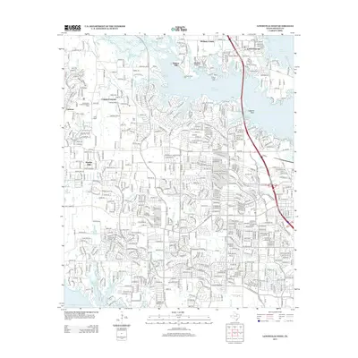
2013 Map of Lewisville West
USGS Topo · Published 2013About this map
Lake Lewisville dominates the northeastern landscape of this Denton County quadrangle, where the finger-like inlets of Hickory Creek and Poindexter Br define the suburban and recreational character of the area. The map illustrates the 2013 development patterns of communities like Lantana, Copper Canyon, and Double Oak, showing how residential growth has filled the spaces between historical markers. Local heritage is preserved in sites such as Chinn Cem and Martin Cem, while institutional landmarks like the Soroptimists Crippled Childrens Camp and Camp Argyle occupy the western terrain. The southern edge is anchored by the upper reaches of Grapevine Lake, illustrating the significant role of water management and reservoir planning in North Texas. The intricate network of local streets, including Justin Rd and Wichita Trl, connects established settlements like Lake Dallas and Crockett to the expanding suburbs and parks like Sycamore Bend Park.
Find a feature on this map
25 named features on this map. Tap any name to fly to it.
Don’t see what you’re looking for? This feature index may not catch every label — zoom into the map to look around manually.
Map Details
Editions of this 2013 Lewisville West Map
This is the sole edition of this map. No revisions or reprints were ever made.
Other maps of this area

1891 · Dallas
USGS Topo · 1:125,000

1893 · Dallas
USGS Topo · 1:125,000

1894 · Fort Worth
USGS Topo · 1:125,000

1925 · Mc Kinney 3-c
USGS Topo · 1:48,000

1925 · Dallas 2-b
USGS Topo · 1:48,000

1929 · Frisco
USGS Topo · 1:62,500

1931 · Carrollton
USGS Topo · 1:62,500

1931 · Grapevine
USGS Topo · 1:62,500

1954 · Dallas
USGS Topo · 1:250,000

1954 · Sherman
USGS Topo · 1:250,000