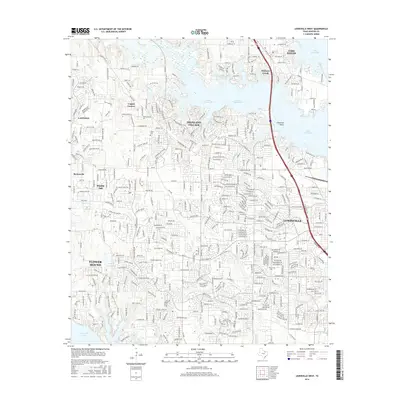
2016 Map of Lewisville West
USGS Topo · Published 2016About this map
Lantana and the surrounding Denton County communities sit at a busy intersection of suburban expansion and conserved natural shorelines. The landscape is defined by its relationship with the water, anchored by the Hickory Creek Arm of Lake Lewisville to the north and the northern reaches of Grapevine Lake to the south. This era shows the dense residential grid of Highland Village and Lewisville contrasted with the more open, creek-carved terrain of Copper Canyon and Double Oak. For the local historian, the map preserves the locations of the Chinn Cem and Martin Cem, small markers of the area's earlier rural character that persist amidst modern development. Significant drainage features like Poindexter Br and Timber Cr illustrate the original topography that dictated the placement of early homesteads before the 21st-century building boom.
Find a feature on this map
25 named features on this map. Tap any name to fly to it.
Don’t see what you’re looking for? This feature index may not catch every label — zoom into the map to look around manually.
Map Details
Editions of this 2016 Lewisville West Map
This is the sole edition of this map. No revisions or reprints were ever made.
Other maps of this area

1891 · Dallas
USGS Topo · 1:125,000

1893 · Dallas
USGS Topo · 1:125,000

1894 · Fort Worth
USGS Topo · 1:125,000

1925 · Mc Kinney 3-c
USGS Topo · 1:48,000

1925 · Dallas 2-b
USGS Topo · 1:48,000

1929 · Frisco
USGS Topo · 1:62,500

1931 · Carrollton
USGS Topo · 1:62,500

1931 · Grapevine
USGS Topo · 1:62,500

1954 · Dallas
USGS Topo · 1:250,000

1954 · Sherman
USGS Topo · 1:250,000