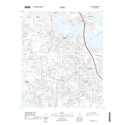
2019 Map of Lewisville West
USGS Topo · Published 2019About this map
Lake Lewisville and its sprawling Hickory Creek Arm dominate the northern landscape of this region, where the rapid suburbanization of Denton County is evident. The intricate residential networks of Highland Village and Lewisville flank the eastern reservoir shore, while Flower Mound and Lantana define the southern and western reaches. Amidst this modern expansion, small fragments of the area's rural roots remain, such as Martin Cem and Chinn Cem, providing essential points of reference for genealogists. The map also captures the confluence of major waterways and transport corridors, including the path of I-35e crossing the lake at Hickory Creek and the southern edge of Grapevine Lake. Small tributaries like Timber Cr and Prairie Cr weave between established neighborhoods and newer developments like Copper Canyon and Double Oak.
Find a feature on this map
29 named features on this map. Tap any name to fly to it.
Don’t see what you’re looking for? This feature index may not catch every label — zoom into the map to look around manually.
Map Details
Editions of this 2019 Lewisville West Map
This is the sole edition of this map. No revisions or reprints were ever made.
Other maps of this area

1891 · Dallas
USGS Topo · 1:125,000

1893 · Dallas
USGS Topo · 1:125,000

1894 · Fort Worth
USGS Topo · 1:125,000

1925 · Mc Kinney 3-c
USGS Topo · 1:48,000

1925 · Dallas 2-b
USGS Topo · 1:48,000

1929 · Frisco
USGS Topo · 1:62,500

1931 · Carrollton
USGS Topo · 1:62,500

1931 · Grapevine
USGS Topo · 1:62,500

1954 · Dallas
USGS Topo · 1:250,000

1954 · Sherman
USGS Topo · 1:250,000