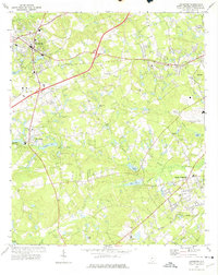
1972 Map of Lexington
USGS Topo · Published 1974About this map
The town of Lexington serves as the focal point for this early 1970s survey, illustrating a period of residential growth and industrial activity along the Southern RR railroad line. The landscape is defined by the winding paths of Fourteenmile Creek and Twelvemile Creek, with numerous ponds and mill sites that speak to the area's agricultural and milling roots, such as the Saxe-Gotha Millpond near Red Bank. The transition toward a regional transportation hub is evident in the presence of the Columbia Metropolitan Airport and the expanding road network connecting the surrounding communities.
Find a feature on this map
48 named features on this map. Tap any name to fly to it.
Don’t see what you’re looking for? This feature index may not catch every label — zoom into the map to look around manually.
Map Details
Editions of this 1972 Lexington Map
3 editions found
Other maps of this area

1904 · Columbia
USGS Topo · 1:125,000

1941 · Spartanburg
USGS Topo · 1:250,000

1944 · Gilbert
USGS Topo · 1:62,500

1944 · Edmund
USGS Topo · 1:62,500

1946 · Irmo
USGS Topo · 1:24,000

1947 · Columbia North
USGS Topo · 1:24,000

1948 · Irmo
USGS Topo · 1:24,000

1948 · Columbia North
USGS Topo · 1:24,000

1953 · Spartanburg
USGS Topo · 1:250,000

1954 · Augusta
USGS Topo · 1:250,000