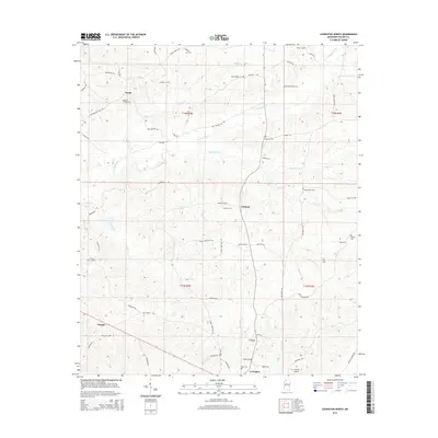
2015 Map of Lexington North
USGS Topo · Published 2015About this map
Lexington serves as the southern anchor for this portion of Holmes County, where the landscape transitions into a complex network of creek drainage systems. The terrain is defined by the winding paths of Fannegusha Cr and Whites Cr, which cut through the rural landscape between small settlements like Ituma and Lebanon. For genealogical researchers, the map is particularly valuable for its high density of family and community burial sites, such as Wanlaw Cem, Jordan Bailey Cem, and Beall-Stigler Cem. The presence of Oregon in the southwest corner and the C. A. Moore Airport near the southern boundary reflects the mix of old rural community centers and modern infrastructure. Transport in the area is largely defined by local routes such as Old Tchula Rd and Lower Louisville Rd, which follow the natural contours of the northern Mississippi hills.
Find a feature on this map
65 named features on this map. Tap any name to fly to it.
Don’t see what you’re looking for? This feature index may not catch every label — zoom into the map to look around manually.
Map Details
Editions of this 2015 Lexington North Map
This is the sole edition of this map. No revisions or reprints were ever made.
Other maps of this area

1940 · Seven Pines
USGS Topo · 1:62,500

1940 · Lexington
USGS Topo · 1:62,500

1953 · Greenwood
USGS Topo · 1:250,000

1953 · West Point
USGS Topo · 1:250,000

1956 · Greenwood
USGS Topo · 1:250,000

1957 · Lexington
USGS Topo · 1:62,500

1957 · Seven Pines
USGS Topo · 1:62,500

1958 · West Point
USGS Topo · 1:250,000

1958 · Seven Pines
USGS Topo · 1:62,500

1958 · Lexington
USGS Topo · 1:62,500