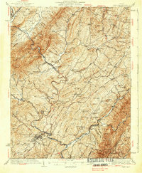
1937 Map of Lexington
USGS Topo · Published 1937About this map
Lexington stands as the cultural and geographic center of this Rockbridge County landscape, where the North River meets Woods Creek. In the mid-1930s, the region was defined by a dense network of rural infrastructure, from the Limerik Bridge to numerous neighborhood institutions like Timber Ridge Ch and Monmouth Sch. The industrial and agricultural heritage of the Shenandoah Valley is visible in features such as McClung Mill and the convergence of major rail lines, including the Chesapeake and Ohio RR and the Baltimore and Ohio RR.
Find a feature on this map
171 named features on this map. Tap any name to fly to it.
Don’t see what you’re looking for? This feature index may not catch every label — zoom into the map to look around manually.
Map Details
Editions of this 1937 Lexington Map
3 editions found

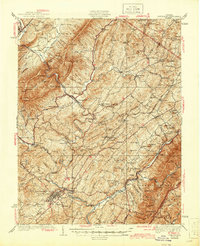
Other maps of this area

1894 · Staunton
USGS Topo · 1:125,000

1894 · Natural Bridge
USGS Topo · 1:125,000

1894 · Lexington
USGS Topo · 1:125,000

1894 · Natural Bridge
USGS Topo · 1:62,500

1901 · Monterey
USGS Topo · 1:125,000

1907 · Natural Bridge Special
USGS Topo · 1:62,500

1932 · Lexington
USGS Topo · 1:48,000

1935 · Buena Vista
USGS Topo · 1:48,000

1935 · Amherst
USGS Topo · 1:48,000

1936 · Vesuvius
USGS Topo · 1:48,000