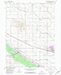
1962 Map of Lexington West
USGS Topo · Published 1984About this map
The Platte River valley in Dawson County defines this landscape, where early pioneer routes and modern transportation infrastructure converge. Evidence of the westward migration is preserved in the Emigrant Trail (Approximate Location) following the north bank of the river, marked by a specific Historical Marker near the Thirthymile Canal. The city of Lexington serves as the regional hub, showing significant urban expansion by the early 1980s.
Find a feature on this map
29 named features on this map. Tap any name to fly to it.
Don’t see what you’re looking for? This feature index may not catch every label — zoom into the map to look around manually.
Map Details
Editions of this 1962 Lexington West Map
2 editions found
Other maps of this area

1896 · Lexington
USGS Topo · 1:125,000

1899 · Lexington
USGS Topo · 1:125,000

1955 · Grand Island
USGS Topo · 1:250,000

1957 · Grand Island
USGS Topo · 1:250,000

1958 · Grand Island
USGS Topo · 1:250,000

1962 · Lexington West
USGS Topo · 1:24,000
1962 · Buffalo
USGS Topo · 1:24,000

1962 · Lexington East
USGS Topo · 1:24,000

1962 · Bertrand NW
USGS Topo · 1:24,000
1962 · Lexington NW
USGS Topo · 1:24,000