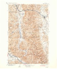
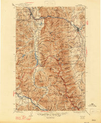
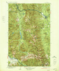
1932 Map of Libby
USGS Topo · Published 1932About this map
Troy and Libby anchor this early 1930s survey of the northwestern Montana mountains, where the industrial footprint of the Great Northern railroad follows the curve of the Kootenai River. The landscape is dominated by the Purcell Mountains and Cabinet Mountains, territories defined by high-altitude lookout stations such as those on Spar Peak and Goat Mtn.
Find a feature on this map
112 named features on this map. Tap any name to fly to it.
Don’t see what you’re looking for? This feature index may not catch every label — zoom into the map to look around manually.
Map Details
Editions of this 1932 Libby Map
3 editions found
Other maps of this area

1909 · Cataldo
USGS Topo · 1:125,000

1911 · Cataldo
USGS Topo · 1:125,000

1911 · Priest Lake
USGS Topo · 1:250,000

1913 · Priest Lake
USGS Topo · 1:250,000

1920 · Libby
USGS Topo · 1:125,000

1920 · Jennings
USGS Topo · 1:125,000

1930 · Libby
USGS Topo · 1:125,000
1932 · Libby
USGS Topo · 1:125,000

1932 · Trout Creek
USGS Topo · 1:125,000

1935 · Thompson Lakes
USGS Topo · 1:96,000