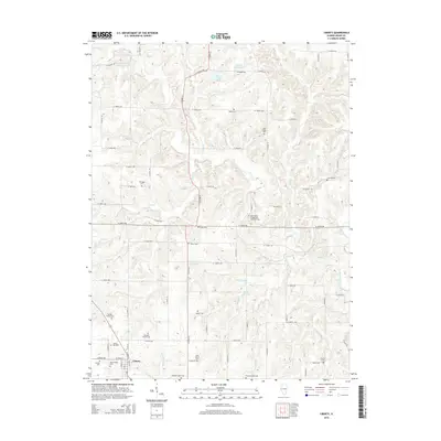
2015 Map of Liberty
USGS Topo · Published 2015About this map
Liberty serves as the central hub of this Adams County landscape, situated at a crossroad where local routes intersect against a backdrop of dissected farmland and creek bottoms. The geography is defined by the intricate branching of McKee Cr, Lierle Cr, and Curl Cr, which have carved deep drainage patterns through the terrain. For genealogists, the map is remarkably dense with family burial sites and community churchyards, reflecting the long-established agricultural roots of the area. Notable sites include the Saint Peters Evangelical Lutheran Cem and several private plots like the Williams Family Cem and Grubb Family Cem. The presence of Harrell Lake North and Columbus-Dry Gulch Club Lake indicates the importance of managed water resources in this rural landscape. This map offers a clear view of the rural road network, including the N 1200th Ave corridor, providing a precise spatial context for twentieth-century family history and land use research.
Find a feature on this map
84 named features on this map. Tap any name to fly to it.
Don’t see what you’re looking for? This feature index may not catch every label — zoom into the map to look around manually.
Map Details
Editions of this 2015 Liberty Map
This is the sole edition of this map. No revisions or reprints were ever made.
Other maps of this area

1925 · Liberty
USGS Topo · 1:62,500

1926 · Mt Sterling
USGS Topo · 1:62,500

1927 · Liberty
USGS Topo · 1:62,500

1929 · Mt Sterling
USGS Topo · 1:62,500

1946 · Augusta
USGS Topo · 1:62,500

1948 · Quincy
USGS Topo · 1:250,000

1948 · Camp Point
USGS Topo · 1:62,500

1949 · Augusta
USGS Topo · 1:62,500

1956 · Quincy
USGS Topo · 1:250,000

1958 · Burlington
USGS Topo · 1:250,000