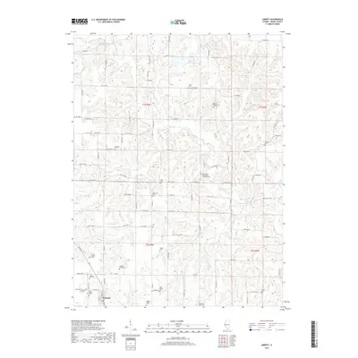
2018 Map of Liberty
USGS Topo · Published 2018About this map
The village of Liberty anchors this portion of Adams County, surrounded by a landscape defined by the drainage networks of McKee Cr and its many tributaries, including Figley Br and Walker Br. This map captures a rural Illinois community with an unusually high density of small, family-named burial grounds, which suggests a deeply rooted genealogical history. Scattered among the farms and creek bottoms are sites such as the Grubb Family Cem, Williams Family Cem, and Clark Family Cem.
Find a feature on this map
99 named features on this map. Tap any name to fly to it.
Don’t see what you’re looking for? This feature index may not catch every label — zoom into the map to look around manually.
Map Details
Editions of this 2018 Liberty Map
This is the sole edition of this map. No revisions or reprints were ever made.
Other maps of this area

1925 · Liberty
USGS Topo · 1:62,500

1926 · Mt Sterling
USGS Topo · 1:62,500

1927 · Liberty
USGS Topo · 1:62,500

1929 · Mt Sterling
USGS Topo · 1:62,500

1946 · Augusta
USGS Topo · 1:62,500

1948 · Quincy
USGS Topo · 1:250,000

1948 · Camp Point
USGS Topo · 1:62,500

1949 · Augusta
USGS Topo · 1:62,500

1956 · Quincy
USGS Topo · 1:250,000

1958 · Burlington
USGS Topo · 1:250,000