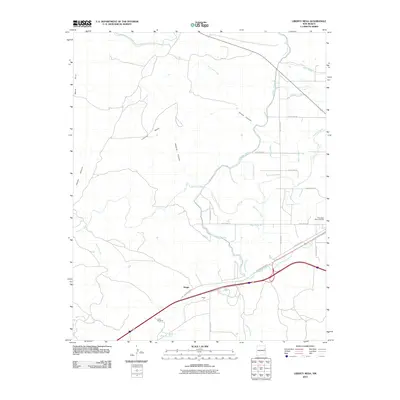
2010 Map of Liberty Mesa
USGS Topo · Published 2010About this map
Liberty Mesa and the surrounding high plains of Quay County dominate this landscape, where the transition from mesas to creek valleys is marked by a complex system of water management. The irrigation infrastructure is particularly detailed, showing the Conchas Canal as it winds through the area, supported by numerous smaller channels like the Bell Lateral, Roberts Lateral, and Coulter Lateral. This network reflects the critical importance of water rights and agricultural planning in this semi-arid region.
Find a feature on this map
34 named features on this map. Tap any name to fly to it.
Don’t see what you’re looking for? This feature index may not catch every label — zoom into the map to look around manually.
Map Details
Editions of this 2010 Liberty Mesa Map
This is the sole edition of this map. No revisions or reprints were ever made.
Other maps of this area

1930 · Tucumcari
USGS Topo · 1:125,000

1954 · Tucumcari
USGS Topo · 1:250,000

1958 · Tucumcari
USGS Topo · 1:250,000

1967 · Trinchera Creek
USGS Topo · 1:24,000

1967 · Liberty Mesa
USGS Topo · 1:24,000

1967 · Tucumcari
USGS Topo · 1:24,000
1968 · Quemado Hills
USGS Topo · 1:24,000

1968 · Bascom Camp
USGS Topo · 1:24,000

1968 · Bulldog Mesa
USGS Topo · 1:24,000

1968 · Carpenter Mesa SW
USGS Topo · 1:24,000