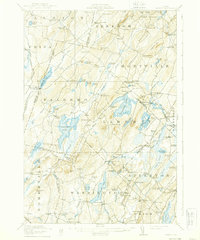
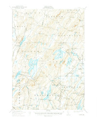
1916 Map of Liberty
USGS Topo · Published 1939About this map
St George Lake and the village of Liberty anchor this mid-1910s interior Maine landscape, where the headwaters of the Sheepscot River and Medomak River drain through a network of ponds and ridges. The map documents an era of small, decentralized settlements defined by numerous corner neighborhoods like Greeley Corner, Shermans Corner, and McFarlands Corner. Of particular interest is the presence of Hibberts Gore, a small unincorporated area, and several vanished post offices such as Montville PO and Palermo PO. The geography is dotted with more than a dozen one-room schoolhouses, including the Handy School, Ridge School, and Ross School, illustrating the community structure before school consolidation. Industry is represented by localized hubs like Branch Mills and Woodmans Mills, while the rugged terrain features landmarks like The Kingdom and the high point of Hogback Mtn.
Find a feature on this map
129 named features on this map. Tap any name to fly to it.
Don’t see what you’re looking for? This feature index may not catch every label — zoom into the map to look around manually.
Map Details
Editions of this 1916 Liberty Map
6 editions found
Other maps of this area

1892 · Waterville
USGS Topo · 1:62,500

1893 · Vassalboro
USGS Topo · 1:62,500

1893 · Wiscasset
USGS Topo · 1:62,500

1898 · Vassalboro
USGS Topo · 1:62,500

1904 · Rockland
USGS Topo · 1:62,500

1906 · Rockland
USGS Topo · 1:62,500

1913 · Waldoboro
USGS Topo · 1:48,000

1915 · Waldoboro
USGS Topo · 1:62,500

1915 · Belfast
USGS Topo · 1:62,500

1916 · Liberty
USGS Topo · 1:62,500