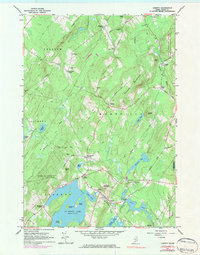
1961 Map of Liberty
USGS Topo · Published 1983About this map
St George Lake dominates the southern landscape of this mid-Maine survey, acting as a focal point for the surrounding village of Liberty and the protected lands of Lake St George State Park. The terrain is defined by a series of prominent ridges and peaks, including Hogback Mountain and Haystack Mountain, which channel the flow of the St George River and Sheepscot River. This region is characterized by numerous small crossroads settlements like Smithton and West Montville, often identified by family names such as Gregorys Corner and McFarlands Corner.
Find a feature on this map
63 named features on this map. Tap any name to fly to it.
Don’t see what you’re looking for? This feature index may not catch every label — zoom into the map to look around manually.
Map Details
Editions of this 1961 Liberty Map
4 editions found
Other maps of this area

1915 · Belfast
USGS Topo · 1:62,500

1916 · Liberty
USGS Topo · 1:62,500

1917 · Belfast
USGS Topo · 1:62,500

1926 · Burnham
USGS Topo · 1:62,500

1932 · Brooks
USGS Topo · 1:62,500

1941 · Belfast
USGS Topo · 1:62,500

1942 · Liberty
USGS Topo · 1:62,500

1948 · Bangor
USGS Topo · 1:250,000

1950 · Belfast
USGS Topo · 1:50,000

1950 · Liberty
USGS Topo · 1:50,000