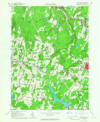
1965 Map of Liberty West
USGS Topo · Published 1967About this map
White Sulphur Springs and the village of Liberty anchor this mid-1960s study of Sullivan County, where the landscape is defined by its transition from agricultural valleys to upland resorts. The map captures a well-established network of rural institutions, from the Liberty-Loomis Hospital and Sch No 12 to the All Souls Chapel near Parksville. Water bodies such as Swan Lake, Revonah Lake, and Matawa Lake are clustered with recreational sites like Blueberry Hill Camp and Camp Olympus, reflecting the area's legacy as a seasonal retreat destination. In the northern reaches, the Beaver Kill flows through a narrow valley, while the local infrastructure is detailed down to individual Water Tanks, a Radio Tower, and the various roads like Benton Hollow Road that connect isolated farms and hilltop peaks like Walnut Mountain.
Find a feature on this map
65 named features on this map. Tap any name to fly to it.
Don’t see what you’re looking for? This feature index may not catch every label — zoom into the map to look around manually.
Map Details
Editions of this 1965 Liberty West Map
3 editions found
Other maps of this area

1909 · Monticello
USGS Topo · 1:62,500

1910 · Neversink
USGS Topo · 1:62,500

1911 · Monticello
USGS Topo · 1:62,500

1921 · Livingston Manor
USGS Topo · 1:62,500

1922 · White Lake
USGS Topo · 1:62,500

1923 · Livingston Manor
USGS Topo · 1:62,500

1942 · White Lake
USGS Topo · 1:62,500

1942 · Neversink
USGS Topo · 1:62,500

1943 · White Lake
USGS Topo · 1:62,500

1943 · Monticello
USGS Topo · 1:62,500